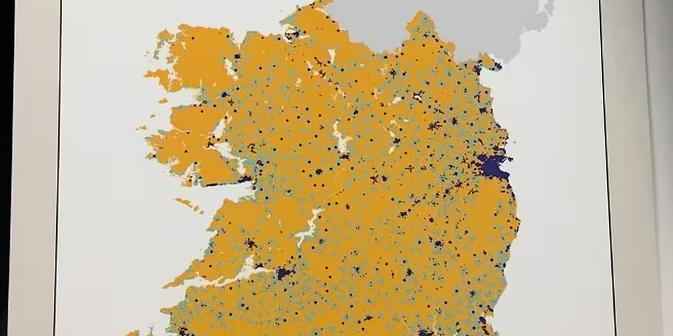
Yesterday afternoon, Minister for Communications Denis Naughten unveiled details of an agreement between the Government and eir. This agreement will see 300,000 premises receive high-speed broadband by the end of 2018. The minister also revealed the updated High-Speed Broadband Map.
This is the map published by the Department of Communications, Climate Action and Environment that illustrates Ireland's access to high-speed broadband.

As you will see from the legend in the bottom right-hand corner, yellow represents the areas of the country that are within the NBP Intervention Area. This means the areas in yellow do not have access to high-quality broadband, or in some cases, any form of broadband.
Blue indicates the areas that have access to high-speed broadband. This is defined as being a minimum of 30mbps. Light blue represents areas that will receive broadband from a commercial operator by the end of 2018.
If you want to know if your area falls under the light-blue category, simply click here. This will bring you to the online hub for the National Broadband Plan. From here, insert your Eircode. This can be found here.
Inserting your Eircode will ensure the most accurate information is shown in the results.
If you are in the light blue area, you can expect to receive high-speed broadband before December 31st 2018. The government expects the NBP to be completed by 2020.
Speaking in Dublin yesterday, Minister Naughten urged customers living in blue areas, but without high-speed broadband to email: Broadband@DCCAE.gov.ie.


