


One of the most popular Google Maps' features is Street View, which allows online viewers to see the cartographic digital reality brought into real images - and laugh at how it splices animals together, or reveals the seedier sides of our towns and villages.
The process involves Google engineers patiently driving a car with a camera on top down every back alley and bohereen to capture every detail.
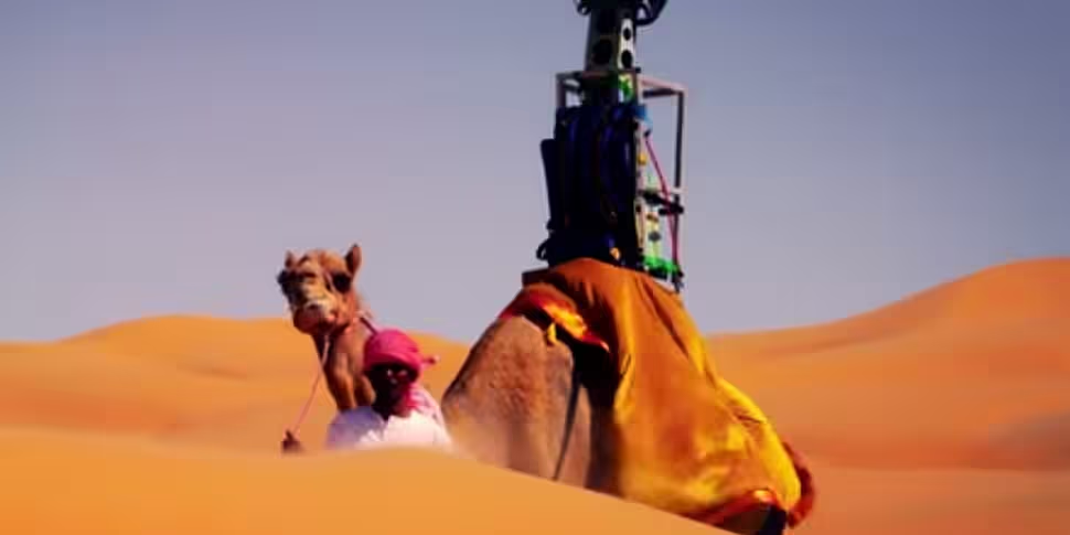
But how do you do that when you’re mapping the sandy dunes of the desert? You strap a camera to a camel, obviously.
Google wanted to bring its ‘Trekker’ camera to the Liwa Desert, near Abu Dhabi in the United Arab Emirates, to make it possible for you to drag and drop the little orange man right bang in the middle of the sand.
But with no roads to traverse, the easiest solution was to use the local fauna, and hire some camels.
Najeeb Jarrar, a Google Product Marketing Manager, explains on the Google Lat-Long blog:
To bring this stunning desert to Street View, we fashioned the Trekker to rest on a camel, which gathered imagery as it walked. Using camels for the collection allowed us to collect authentic imagery and minimize our disruption of this fragile environment...We hope this collection gives you a glimpse of what it may be like to travel the desert as caravan merchants have for the past 3000 years. Should you make the journey here in person, who knows—you may meet some new friends.
You can check out the stunning video, with proper David Lean desert landscapes, here:


