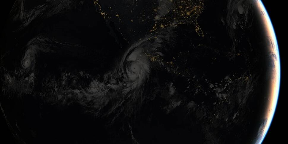
The effects of Hurricane Patricia, which hit Mexico on Friday, have forced thousands of people to flee amid landslides, flooding and damage to property.
Although the storm was downgraded from a Category 5 storm to a Category 2 storm after making landfall, there were still reports of winds hitting speeds of 165mph (270kph), as well as flood waters sweeping away trees and cars.
The sheer size of the storm was captured well by a series of images that astronaut Scott Kelly shared on his Twitter feeds as the storm progressed, moving across the Pacific Ocean and eventually making landfall in Mexico.
Hurricane #Patricia looks menacing from @space_station. Stay safe below, #Mexico. #YearInSpace pic.twitter.com/6LP2xCYcGD
— Scott Kelly (@StationCDRKelly) October 23, 2015
Hurricane #Patricia approaches #Mexico. It's massive. Be careful! #YearInSpace pic.twitter.com/F5LgnjOjey
— Scott Kelly (@StationCDRKelly) October 23, 2015
#Patricia's force isn't lost on me. Thoughts w friends & all in #Mexico #GoodNight from @space_station #YearInSpace pic.twitter.com/FpulnNQleR
— Scott Kelly (@StationCDRKelly) October 23, 2015
Woke up in the night #Patricia update w latest view from @space_station Thoughts continue for all below #YearInSpace pic.twitter.com/MYmYLA3uPw
— Scott Kelly (@StationCDRKelly) October 24, 2015
Cameras attached to the International Space Station also captured images of the hurricane at 12:15 p.m. EDT on October 23, as it moved along with winds of about 200mph.
NASA also issued an image of the hurricane as seen from the space station, which illustrates the extent of the storm and the pinhole eye at the centre.
Finally, a composite image of the storm as it made landfall was captured through infrared data from the geostationary satellites of EUMETSAT and NOAA.

Image © 2015 EUMETSAT/Flickr


