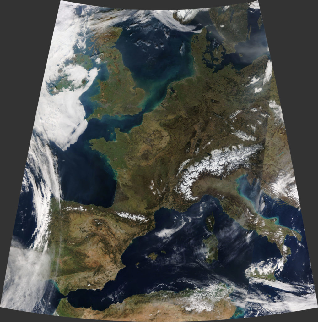
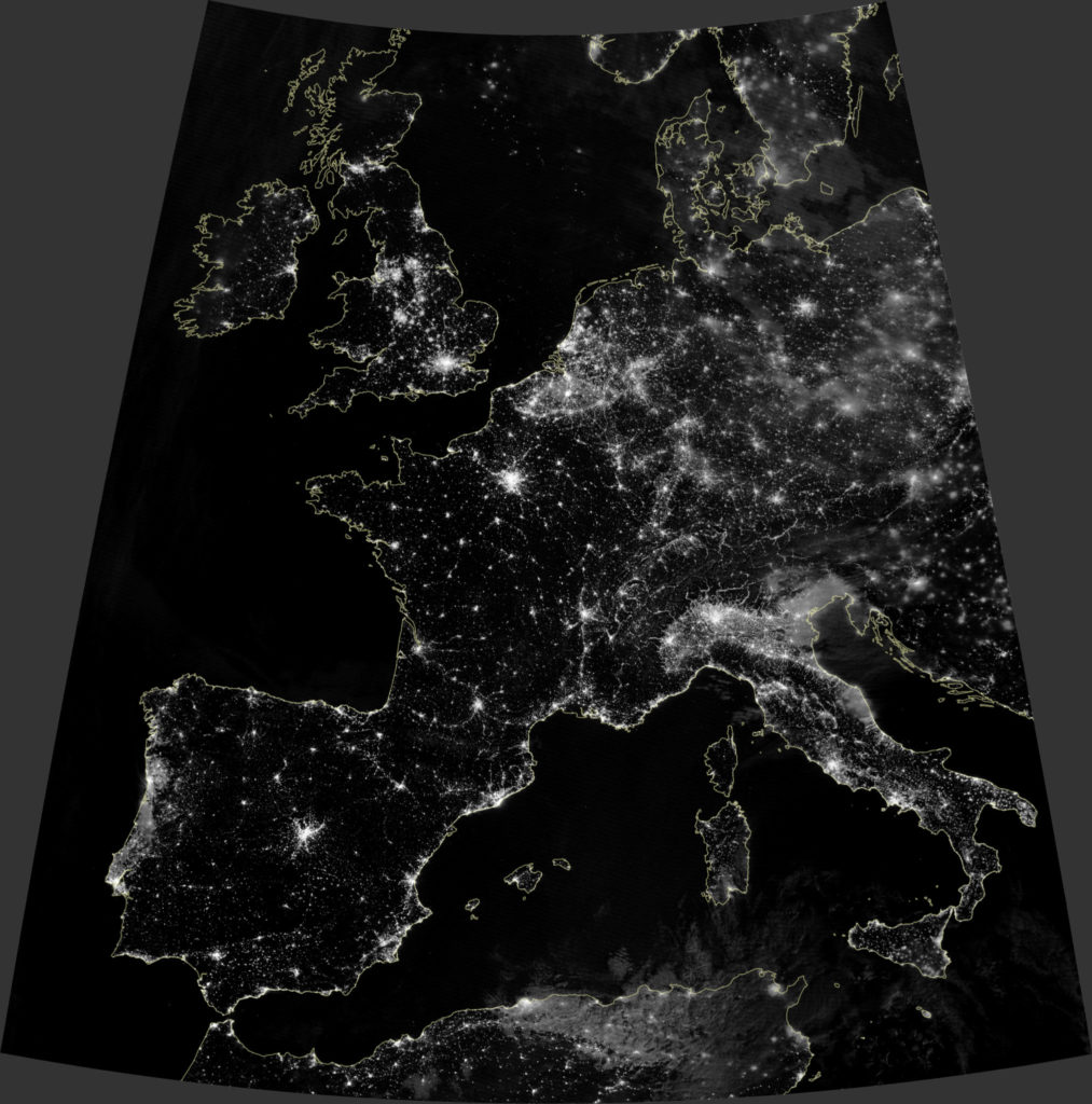
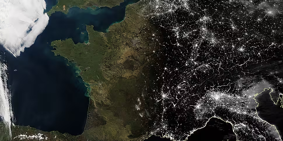
US space agency NASA has released images, showing Europe under a clear sky.
The images were taken on the night of February 26th and the day of February 27th.
NASA has said these views are unusual, given that "Europe stands out as being one of the cloudiest continents".
 NASA Earth Observatory images by Joshua Stevens, using data from the Level 1 and Atmospheres Active Distribution System (LAADS), the Land Atmosphere Near real-time Capability for EOS (LANCE), NASA EOSDIS/LANCE and GIBS/Worldview, and VIIRS day-night band data from the Suomi National Polar-orbiting Partnership
"Aside from relatively sunny Spain and Portugal, clouds regularly darken skies across the rest of Europe, particularly in the winter when the jet stream often steers storm systems directly toward western Europe."
But it added: "With a strong high pressure system hanging over Europe, skies were remarkably clear between February 23rd and 27th - a period when temperatures soared."
The pair of daytime and night-time satellite images also show the contrasting features of the land surface which are often obscured by clouds.
 NASA Earth Observatory images by Joshua Stevens, using data from the Level 1 and Atmospheres Active Distribution System (LAADS), the Land Atmosphere Near real-time Capability for EOS (LANCE), NASA EOSDIS/LANCE and GIBS/Worldview, and VIIRS day-night band data from the Suomi National Polar-orbiting Partnership
For example, in the day image some of the most prominent patterns relate to farming.
Areas with high concentrations of croplands and few forests, most notably in France and Spain, have a light brown colour for winter - more densely forested areas appear darker green.
In the colder, drier continental climate of central and eastern Europe, vegetation - aside from evergreen forests - withers and browns during the winter.
NASA said: "By revealing the locations of cities, the night-time image underscores the human footprint on the landscape.
"Madrid, London, Paris, and Berlin - all capital cities - also stand out as the brightest cities in their respective countries."
The night-time image shows Dublin as the brightest spot on the island of Ireland.


