People in Northern Ireland are being advised not to make unnecessary journeys with parts of the region under a Status Amber rain warning.
It comes as Ireland prepares for another week of severe weather and heavy rainfall Storm Ciarán due to arrive tomorrow.
Areas already hit by heavy rains and flooding will likely be hit again later this week.
Met Éireann senior forecaster Gerry Murphy told Newstalk Breakfast a Status Yellow rain warning currently in place for Kerry is not connected to the storm.
"The rainfall warning for Kerry is for a band of rain that will push up over Ireland this afternoon and this evening," he said.
"That is going to bring some heavy enough falls to places and some spot flooding, especially in the south-west, but it's not directly associated with Storm Ciaran.
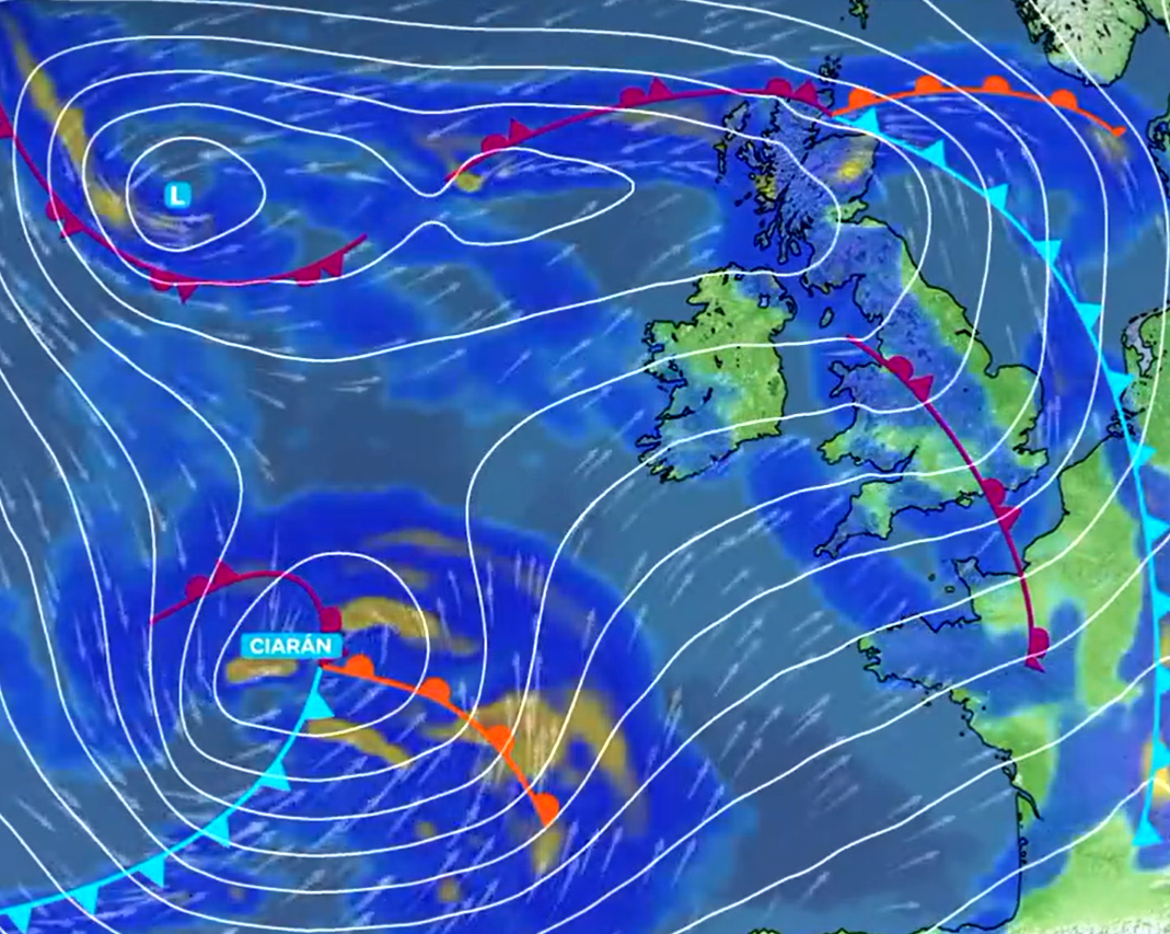
"Storm Ciaran will move eastwards to the south of the country on Wednesday night into Thursday.
"It's really going to bring its stormiest conditions to the south of England and the north-west of France."
 Storm Ciarán approaching Ireland. Image via @metoffice on X
Mr Murphy said Munster and Leinster will likely be worst-hit.
"For Ireland, what's going to happen is we'll be on the northern flank of that depression," he said.
"So, it's going to push rain up over us on Wednesday night into Thursday - mainly affecting Munster and Leinster.
"The rainfall amounts, currently predicted, would indicate they'd be in the Yellow level rainfall amounts.
"But this in itself is sufficient to bring flooding to parts of the east and south, given the fact the ground is saturated and that the river levels are very high.
"It's really Wednesday night into Thursday that Storm Ciaran affects us.
"It's mainly the areas that have been hit already with regard to flooding because the rainfall will be heaviest in the south and in the east of the country," he added.


